The Los Angeles River is the original source of life for the City of Los Angeles. It is where the Tongva and, later, the Spanish built the City’s first settlements and where, today, ethnically diverse neighborhoods prosper. In the 19th and 20th centuries, the River powered the City’s industry and served as an important transportation corridor, creating economic value and growth. As development encroached upon the river’s floodplain, eventual flooding destroyed homes and property, harming people and wreaking havoc on some of the City’s most significant original settlements. Today the City is working to revitalize the Los Angeles River, keeping this rich history in mind. See also, The History of the LA Aqueduct here.
LOS ANGELES RIVER AT A GLANCE
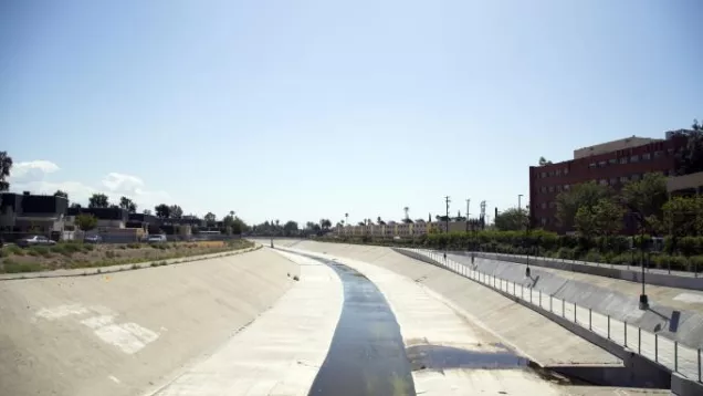
- A series of devastating floods caused the River to be channelized: 1914: $165 million in property damage; 1934: $75 million in damage and 49 deaths; 1938: $900 million in damage and 87 deaths—beginning in the 1930s-1940s the LA River is channelized by the United States Army Corps of Engineers.
- The LA River flows through the nation’s 2nd largest urban region, into two of the world’s busiest port regions, and into the world’s largest water body: the Pacific Ocean.
- The LA River begins in Canoga Park, flows through the San Fernando Valley, along the cities of Burbank and Glendale, along Griffith Park and Elysian Park, through Downtown LA and then through the cities of Vernon, Commerce, Maywood, Bell, Bell Gardens, South Gate, Lynwood, Compton, Paramount, Carson, and Long Beach.
- LA River Watershed: 870 square miles
- LA River Length: 51 miles (First 32 miles in the City of LA)
- The first 32 miles of the River that flow through the City of Los Angeles intersect 7 U.S. Congressional Districts, 10 Council Districts, approximately 20 Neighborhood Council areas, and 12 Community Plan areas.
- Elevation at Origin (Canoga Park): 772 feet
- Elevation at Outlet (Pacific Ocean): 0 feet
- Average Slope: 0.29 percent
- Average Annual Precipitation: 15 inches
- Average Daily Discharge: 320 cubic feet per second or 207 million gallons per day
Within the City of LA, the LA River Corridor is Home to:
- More than 1 million people (Data from 2000 Census)
- More than 390,000 housing units (2000)
- More than 480,000 workers (2000)
- More than 35,000 businesses (2003)
- More than 80 schools (2004-5)
- At the end of 2009 only 4 states had higher unemployment rates than California (12.4%)—Nationwide: 9.7%; Communities Surrounding the River Have Rates that are Much Higher—LA County: 12%; LA City: 13.2%; City of Commerce: 21.1%; Compton: 20.2%; Bell Gardens: 18.9%; Lynwood: 18.8%
FREQUENTLY ASKED QUESTIONS (FAQs)
Please contact us for additional questions or comments about the revitalization of the Los Angeles River at: info.lariver@lacity.org
What is the motivation for the revitalization of the Los Angeles River?
The Los Angeles River has been neglected over the years and, at many locations along its path, is an eyesore. Yet, through the years, activists and the City itself recognized the Los Angeles River as offering huge potential for natural, community, and economic resources which, if harnessed, would present significant opportunities to revitalize the adjacent neighborhoods. Against this background, the City’s Ad Hoc Committee on the Los Angeles River, established in 2002, spearheaded efforts to launch the Revitalization Master Plan – a plan aimed at enhancing existing communities by creating a safe environment with more open space, parks, trails, recreation, environmental restoration, riverfront living and commerce, new jobs, neighborhood identity, economic development, tourism, and civic pride.
Who is responsible for revitalizing the Los Angeles River?
Revitalization of the River is currently a joint effort among the City of Los Angeles, the County of Los Angeles, and the US Army Corps of Engineers. The Arts, Parks, Health, Aging and River Committee currently guides the City's revitalization efforts, and the City’s River Project Office within the Bureau of Engineering is taking a lead role in the implementation process. The process is being coordinated with the County of Los Angeles through the development of a Memorandum of Understanding (MOU). The MOU addresses each agencies’ respective responsibilities for maintenance, liability, security, and project implementation. Further, any changes to the physical configuration of the River’s concrete channel will involve approval and potential funding support by the Federal government.
Who are the key LA River stakeholders?
Every individual, organization, and business in the Los Angeles region is a key River stakeholder. The planning process will involve everyone in decision-making activities via well-publicized workshops, meetings and River-related events.
What is the length of the Los Angeles River?
The entire Los Angeles River runs 51 miles through urban Los Angeles (both through several cities and the County of Los Angeles). This project specifically focuses on a 32-mile stretch from Canoga Park through downtown Los Angeles.
Will other neighboring cities be involved in this effort?
The revitalization of the Los Angeles River is currently being coordinated by the City of Los Angeles. Throughout the planning and implementation process, the City will seek regional cooperation with adjacent cities such as Glendale, Burbank, and Long Beach, along with the County of Los Angeles and other river-related agencies in order to integrate projects and management objectives to leverage funding sources, cost efficiencies, visibility, and community support.
What effect will River Revitalization have on existing projects near the River?
Any work will be coordinated with existing projects and appropriate agencies to minimize or avoid adverse impacts and to leverage opportunities that arise as a result of the planning process.
Will it be possible to remove the concrete from the river?
The Revitalization Master Plan included alternatives to reconfigure the channel dimensions which may include the removal of concrete in portions of the river. Any changes made to the channel will be made to maintain or enhance safety during peak flow events. Any materials removed from the LA River will be disposed or recycled in an environmentally sensitive manner. Removal of the concrete, if possible, will provide creative landscaping opportunities for natural conditions.
Will I be able to jog, walk or ride along the LA River?
Yes, part of the plan to revitalize the Los Angeles River is to maintain and enhance recreational opportunities and overall quality of life along the LA River. We are looking at diverse recreational improvements such as green space, bike paths, sports fields and other opportunities to enjoy the LA River’s resources.
Who is responsible for keeping the LA River safe and clean?
Maintenance of the LA River falls under several jurisdictions within the City, County, and Army Corps of Engineers. The City understands that management of the River must be a shared responsibility among various agencies and organizations. By engaging different partners, the plan can result in a truly collaborative vision with recommendations for inventive and integrated strategies for managing the River.
Will there be a committed effort to prevent crime and blight from impacting new recreation areas along the River?
Yes, a key component of revitalization efforts is to address safety concerns so that everyone can enjoy the River and its environs. This includes designing safe spaces as well as integrating elements such as lighting and maintenance recommendations into the process.
How will existing flood protection be addressed?
The number one priority of the revitalization process is to preserve the flood protection that is provided by the existing river system. No adverse impacts to this protection would be recommended nor implemented. Rather, opportunities to enhance flood protection and safety through a variety of means will be considered. Examples may include the use of detention areas for flood waters, additional channel capacity, and wise watershed practices, for example.
How will revitalization of the River reflect the neighborhood values and aspirations of specific communities and constituencies?
The efforts to revitalize the Los Angeles River will include significant community input throughout the process so that all communities and constituencies have a say in helping design a future blueprint for the River for generations to come.
Will the revitalization of the Los Angeles River include public art?
The planning and implementation effort will invite stakeholders including residents and artists to dialogue on public art standards, projects and policies. The River Project Office will work with the City’s Cultural Affairs Department and other institutions to prepare recommendations for a LA River arts policy.
How will non-English speaking stakeholders be informed of the planning and implementation process and be encouraged to participate?
All meeting notifications and public materials will be translated into Spanish. If requested, materials will also be translated into Korean and Chinese or other languages. Additionally, Spanish-speaking translators are in attendance at public workshops and meetings to provide non-English speakers with on-the-spot translation of proceedings and activities.
Will the Plan seek to incorporate environmentally friendly land use, transportation, and water technologies?
Yes. The revitalization of the Los Angeles River seeks to create a sustainable living and working environment along the River. The City of Los Angeles has already embarked on landmark programs using state-of-the-art technologies and practices to provide alternative sources of clean energy, water conservation, and pollution prevention. Revitalization of the River will seek to showcase and enhance such technologies that may include, but are not limited to, solar energy, water-saving devices, tree planting and use of permeable surfaces to preserve underground water.
Have other cities taken on projects like this?
Numerous cities across the United States have implemented highly successful riverfront projects that have revitalized adjacent communities. Similar projects include:
- San Antonio Riverwalk – San Antonio, TX
- Brush Creek Cultural Corridor – Kansas City, MO
- Memphis Riverfront Master Plan – Memphis, TN
- Charles River Master Plan – Boston, MA
- Tennessee River – Chattanooga, Tennessee
- Greening of the Platte River – Denver, CO
- River Park and Balboa park Redevelopment – San Diego, CA
- Rio Salado Ecosystem Restoration Project – Phoenix & Tempe, AZ
- North Delaware Riverfront – Philadelphia, PA
- Allegheny Riverfront – Pittsburgh, PA
- Rio Besos – Barcelona, Spain
- Cheonggye Stream Project – South Korea
Success stories include, for example, the San Antonio Riverwalk which has been the catalyst of over $2.8 billion in tourism for the City of San Antonio and the Brush Creek Cultural Corridor in Kansas City which has generated more than $750 million in new development.